|
|
 |

 Mar 1, 2010 Mar 1, 2010
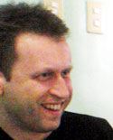
Alastair Duncan: GIS Guru
SIBAT: Sibol ng Agham at Teknolohiya; an NGO for sustainable agriculture and renewable energy
NGO: non-governmental organization with a social advocacy (non-profit organization)
GIS: geographic information system; read: land mapping
LIDAR: Light Detection And Ranging - laser transmits a beam of light to the ground and measure the time it takes for the beam to echo back. The resulting feedback is the basis for a ground map. LIDAR has the ability to resolve very small targets and penetrate vegetation.
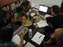
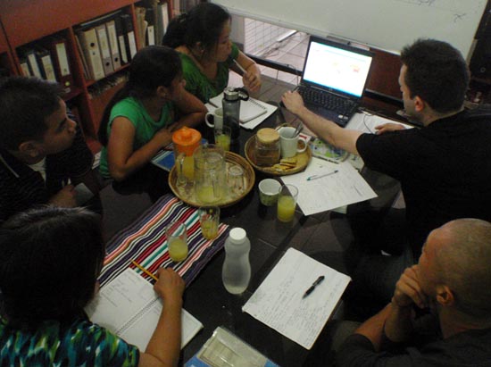
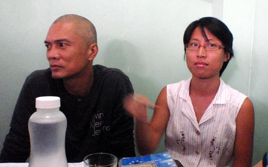
GIS Workshop
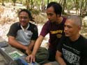
While doing web work for SIBAT, I got wind that a LIDAR technology expert was going to conduct a 7-day GIS workshop for the staff. I was quick to raise my hand to participate, unmindful I wasn't exactly invited (I'm not even staff!).
Getting Lost
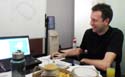
Since I got lost in the middle of Durham Forest in Canada during my first winter mountain bike ride, my interest in getting my way back from the wilderness and learning the survival skills needed became paramount. Stemming from that incident, I familiarized myself with a compass and now, the GPS. With the arrival of Alastair Duncan, I was ready to kick things up a few notches higher.
 |
 |
 |
|
 |
The moment a map is made, it's already obsolete due to inaccuracies brought about by assumptions in its development, the passing of time and built-in errors. There is no such thing as a perfect map and you should be vigilant about taking any map as gospel.
-- Alastair Duncan
|
 |
|
 |
|
 |
What We Learned
The entire workshop had my name in big bold letters on it. By way of practical exercises, Al taught us:
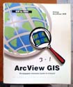
- how to use various GIS software (ArcView GIS, QGIS, MapWindow)
- how to use the web to download GIS data for free (maps + attributes, tracks, waypoints, etc.)
- how to use software + data to extract meaningful results (eg - how to delineate water reservoirs from a terrain map)
- how to better use the more popular Google Earth in combination with other GIS data and software
- how to geo-reference a map so that it shows exactly where the map is in the world map
Why is Al Duncan, Fab People?
But the above alone doesn't make one a Fab People (otherwise every expert is now Fab People) - the benchmark is considerably higher. Why is Al Duncan, Fab People? Let me count the ways:
- he knows his stuff inside out...an expert in his field
- he shares his knowledge base with no remuneration (free GIS anyone?)
- he conducted his free workshop while he was on vacation in the Philippines!
- when we could not transfer the GIS content of his laptop, he donated the laptop, with the leather case, with the mouse, the GIS books, etc....now, that is FAB!
Practical Application
Thanks to Al, when I climb a mountain and come upon a magnificent Almaciga Tree in the thick brushy wilderness where I see nothing around me but tall trees (no identifiable landmark), I know that when I get back home and download my GPS data into my hard drive, and open up my GIS software, I can pin-point the exact whereabouts of that Almasiga Tree on the map (+ elevation!). From the contours of the map, I can even plot the exact route we took from the jump-off to where we summited, to where we traversed to. I can save the file as a .KML file and attach it on an email and have my friends/colleagues view that map on Google Earth! Empowering!
Ending Thoughts
I love this guy! Al Duncan, propagate and prosper. You raise the benchmark for volunteer work. Next time you visit the Philippines, beer is on me! The world needs more Fab People like you!
--- TheLoneRider
»» next story: Beach Camping, Sea Kayaking and Skin Diving with Outback Greg on his Tribal Adventures Tour
»» next Fab People story:
 (Apr 26, 2010) My friends and I were just leaving Casaroro Falls when I noticed the odd sign on the fence of a house rented by a German resident, 'No Trespassing. My dogs could eat you and that might make them sick'...more »»
»» back to Fab People
»» back to Homepage
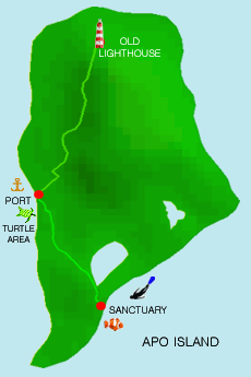
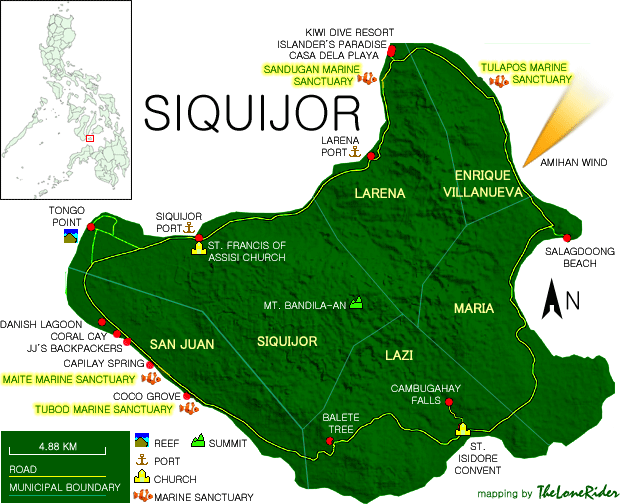
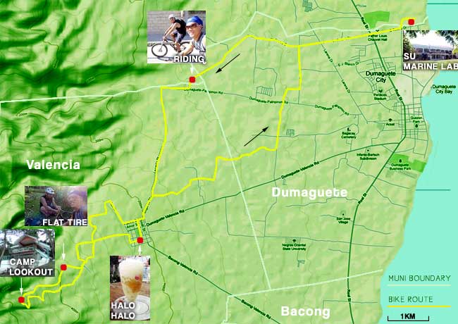
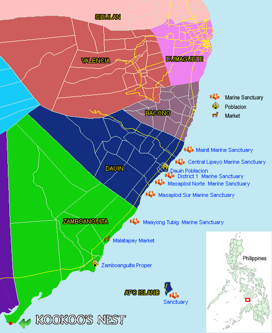
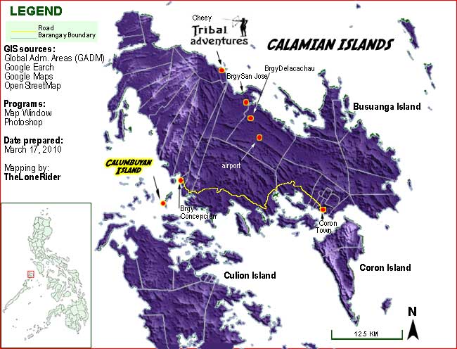
Maps I created since learning GIS from Al Duncan:
|
|

WANT YOUR SITE
TO RANK HIGHER ON
 Google rank:
#1 out of 425,000
as of July 9, 2010
Keywords:
traveling, skin diving
mountain biking
SEO Service
Web Design Service
 |


|