|
|
 |

 April 14 - 15, 2007 April 14 - 15, 2007
BEAT THE TERRACES
Freedom of the Hills
Armed with knowledge gained from the bible of mountaineering,
Freedom of the Hills, I was stoked to try out my newfound skill - navigation and route finding. It sounded simple enough - get your compass bearing on a destination, plot it on a map, and read the contour intervals of the map to find a suitable route.
Race Mechanics
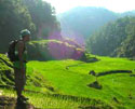
Beat the Terraces is an annual orienteering adventure race set in the spectacular rice terraces of Banaue. It's on its 2nd year, this time with cash prizes of up to P15,000 for the winning team. A team of up to 2 people is given a topographic map. From the master map displaying 14 pin-point locations (Control Points or CP), the racers copy those CP locations into their maps. With the aid of a compass and clues, participants race to each one of them on foot in chronological order. The route is about 20 kilometers with a total vertical gain of 1,500 feet spanning the surrounding hills, trails, terraces and communities under the scorching heat of the sun. Team with the shortest time wins.
The Players
There were about 24 teams, each team with 2 members, either all-men or mix. Orienteering seems to be its own niche group with the participants knowing or being familiar with each other. It's a homogeneous outdoor-adventure-type gathering - mountaineers, campers, mountain bikers, adventure racers, all of them adrenaline junkies. It was announced that the fast teams can finish the race in 5 hours. Not surprisingly, with the organizer being a UP Mountaineers member, there were about 5 UPM team entries.
A Given CP
I thought we would be given coordinates or bearings that we plot on the map to determine the CPs. No. The CPs were already ploted on the master map and we just had to copy them. Thumbie explained that plotting a numerical coordinate is liable to increase the margin of error. Initially, I thought it made the race easier.
Trail Use
In order to minimize the environmental impact, use of existing trails were encouraged instead of blazing new ones. This puts an added challenge into the race. You might see the CP from a distance, but unless you figure out which trail leads there, it's still a wild goose chase. Following a trail and choosing which fork to take adds dimension to its difficulty. Worse, a trail may just disappear into a thick mossy forest, leaving you lost with no landmark to get a bearing from.
CP1
Before racing to CP1, I took the bearings of all the CPs into the map. From Banaue Hotel, we had to climb a hill summit to get to CP1. It should be easy because a peak is just a small area, it's practically a point position. It wasn't that easy. There was brush on the trails and peak. When I didn't see the CP, I assumed my bearings were wrong. I descended down the hill, went up another high place to ascertain my original reading. I went up again, this time, not finding the trail to the peak. I went down again and took the peak from the other side. I still didn't see anything. I was already exhausted just from climbing up and down the hill. Self-doubt was coming into play - do I really have my bearings right? I gave it another look-around into the thick brush and found the CP just 10 feet away! What should have taken 15 minutes took me 1.5 hours. I heard that some teams already quit at CP1 because they couldn't find the CP and couldn't go any further.
CP2
I already sighted CP2 from CP1. I thought it would be easier. The clue was 'on a ridge'. Since the clue to CP3 was 'old study house', meaning indoors, 'on a ridge' implies CP2 was outdoors. I could have gone straight for CP2 accross the rice fields, but I thought going through the road and getting to CP2 from behind was easier. That's when all the problems started. My only trusted site was Banaue Hotel. By taking the road, I lost sight of the hotel. Therefore, I couldn't take a line-posiion to determine where I was on the road. I thought about getting my bearing from CP1, but with so many hills, I didn't know which one was CP1. I kept going down several ridges but couldn't see anything that resembled what I thought was CP2. I went further out the road hoping I could see the hotel but it remained covered by the ridges. At some point, I came upon a small Ifugao village hidden from the mossy forest. When the village elder saw me with a map and compass, he turned menacing and told me there was no Yamashita treasure in his village. He asked to see my 'Japanese map' though (ha-ha).
The heat was gruelling and I was exhausted. Finally, I had to be honest with myself. If I can't find the CP in 3 hours, then it won't make a difference if I had another hour or another day. Chances are, I won't find it. With that, I threw in the white towel. Besides, I thought that at that point, other teams had already crossed the finish line. I didn't know until later in the day that the earliest finishers took about 8 hours!
It turned out that CP2 was not outdoor but inside a building. Of course, everyone was looking for an outdoor CP on a ridge, not a CP inside a building on a ridge.
Easter Egg Hunt
This being my first, I don't know what the conventions are about orienteering races, but I think once the racers are within 20 feet of the CP, the CP should already be visible, enabling the racers to get their number quickly and proceed to the next CP. After all, a pentel mark on a 1:50,000 map is probably that size - 20 feet. Concealing the CP (or using misleading clues) so the racers don't initially find it puts a whole new dynamic into the race. Such was the case with CP2. I believe all but 1 team had a terribly difficult time with it. One team was able to get to the place quickly, but still spent an additional 7 HOURS running around, descending the ridge, climbing back up again, over and over before they figured out the CP was hidden. When that happens, it's no longer an orienteering race but an easter egg hunt.
Doing It Alone
Since I was doing it alone, I realized then what the drawbacks were. Without a team mate, there was no one to validate my bearings. When I was exhausted and took the CP bearings again, they turned out different from my earlier results. I was sure I was doing it right both times, so which one is accurate? In hindsight, I realized that in my second reading, I used magnetic north on my map instead of simply aligning the compass meridian lines. But my judgement was already clouded by fatigue, heat and frustration.
Ending Thoughts
Reading the book is one thing, going out there in the heat, through thorny brushes, scaling up a peak and descending down a river valley is totally another thing. A lot of factors came into play to test how committed I am. Unlike mountain climbing, no matter how fatigued, no matter how hot the sun gets, I'm assured that every step I take brings me closer to the peak. With orienteering, specially to a newbie like me, it's like a black hole where I constantly spin my wheels and still find out I'm no nearer to my objective than I was 4 hours ago. With that mounting exasperation, logic to continue diminishes, and with that, the mind gives up and consequently, the body quits.
Even if I had all the time in the world, I'm still not sure if I would finish. How the others managed to complete all the CPs AND finish is a litmus test to their navigation skill, their fitness level and mental resolve. I am humbled by not finishing what I came out to do (although rich in experience) but at the same time inspired by those who came out of it winners.
--- TheLoneRider
** My digicam is still jammed. Pictures courtesy of Fred and Dennis.
- When the race starts, don't just plot CP1 and take off. Take time to get the bearings of prominent landmarks (tall peaks, imposing structures) and plot them on the map. As the race progress and you don't exactly know where you are on the map, they will serve as trusted sites to get a bearing on.
- Every once in a while, keep looking at your trusted sites to gain familiarity with it. From a different angle, they may not be recognizable.
- At the start of the race, when your thinking is still clear and fresh, start getting the bearings of ALL the CPs. If you wait to get to one CP first before getting the bearing on the next one, specially towards the end of the race, the exhaustion, heat and mounting frustration may already cloud your thinking.
(this wish list should not take away from the long hours of planning and preparation that put into making this event a success)
- a marshall on every CP - to ensure the integrity of the race and provide emergency assistance if necessary
- a visible CP within a 20-ft radius
- precise and clear clues - this should be an aid and not a source of confusion
- bigger scale map - since only a quadrant of the 1:50:000 map was used for the CPs, would it have been easier for the racers if the quadrant was the entire map but increasing it's scale to 1:12,5000? Someone said it won't make it any easier but I don't see why.
- Point Posiiton - a precise point on the map. This shows exactly where you are on the map. This is the ideal scenario.
- Line Position - by plotting a bearing on a map, you draw a straight line from your objective to your position. You are somewhere along this line but you don't know exactly where on this line. If you happen to be on a road, then where this line intersects the road is where you are. The line position + the road gives you the point postion.
- Area Position - you know you are somewhere on a given broad area on a map but don't know exactly where. To get your point location, first draw a line position from a trusted site. Second, draw another line position from another trusted site, ideally 90 degrees from the first trusted site. Where these 2 lines meet is your point position. This is often times called 'triangulation'.
- Getting a Bearing - using a compass, you point to your objective, orient the compass to true north (on site) or align the compass' meridian lines on a map (from a map). The degrees on the direction of travel is your bearing.
- Plotting a Bearing - with a given bearing, turn your body with the compass until the needle points to true north (for site plotting). For map plotting, simply align the compass meridian lines to the North-South direction of the map. Where the bearing points to is your direction of travel.
Thumbie Remigio
Mobile Phone: 0916-3858322
Land line: (063) 932-9071
E-mail address: thumbieremigio@yahoo.com
Norlan Trajano
Philippine Tourism Authority
Telephone No: 02-5235949/09288232185
- Thumbie Remigio - for allowing me to cover the event (and his accomodations). Thumbie is a seasoned adventure racer, mountaineer and fitness buff. Among his other regular event is the CECON 24-hour mountain bike race.
- Philippine Tourism Authority - for supporting the sport we hold dear
An exhausted racer after crossing the finish line
(April 15, 2007) I used to be fascinated by the awesome grandeur of the Banaue rice terraces. Now, after running up, down and side-to-side of its height and breath for hours upon hours in this unbearable heat, I don't even want to see anything green.

»» next story
»» back to Mountaineering
»» back to Homepage
|
 |


 |

|
 April 14 - 15, 2007


 Outdoor Adventure Tours
 SandCastles Palawan Beach Resort


